Redesigning New York’s Subway Diagram
New York, NY
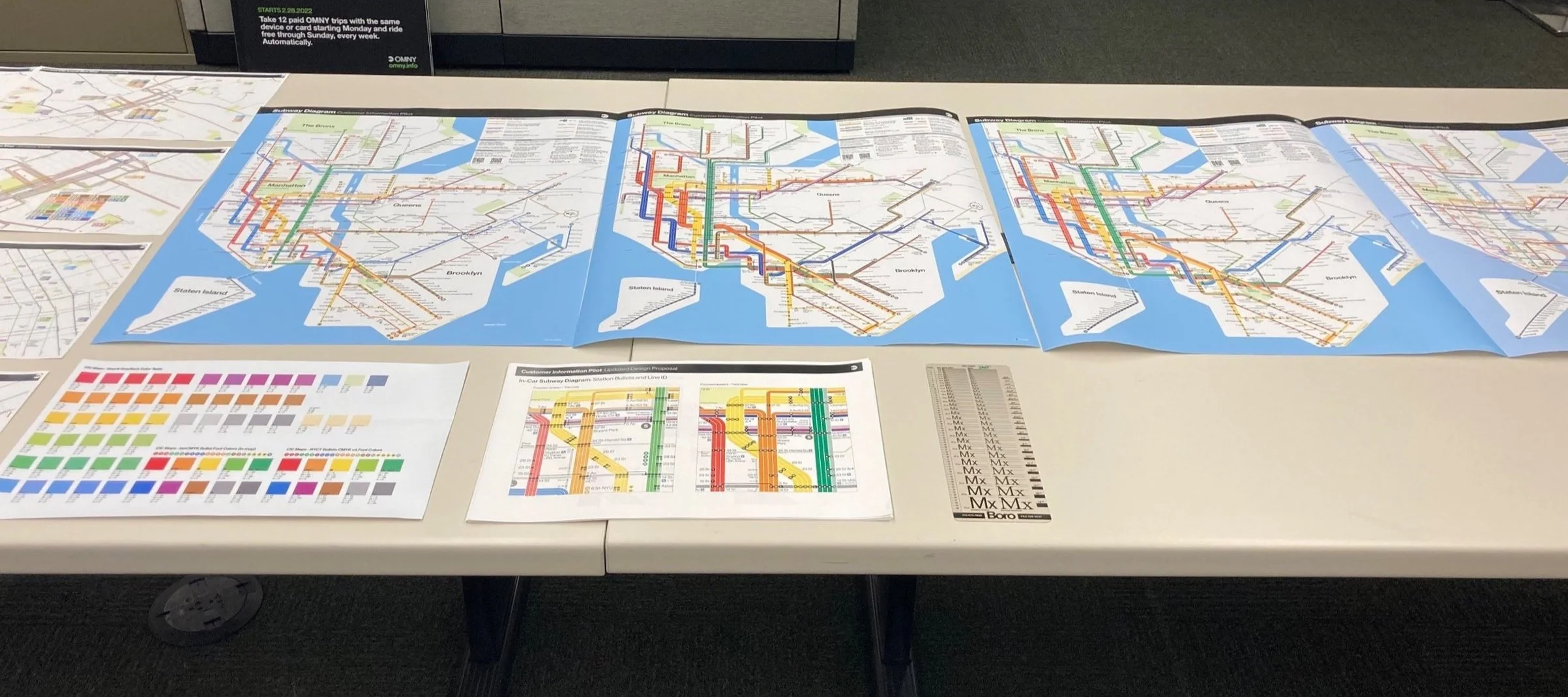
New York’s Metropolitan Transportation Authority (MTA) is undergoing a reimagining of its printed transit maps through the Customer Information Center Pilot. The pilot tests four new maps, which show different ways of sharing information about buses, subways, and the neighborhoods they serve. The new focus no longer relies on a one-map solution, but instead uses a collection of printed maps and diagrams that work together, each one providing details about different types of transit information.
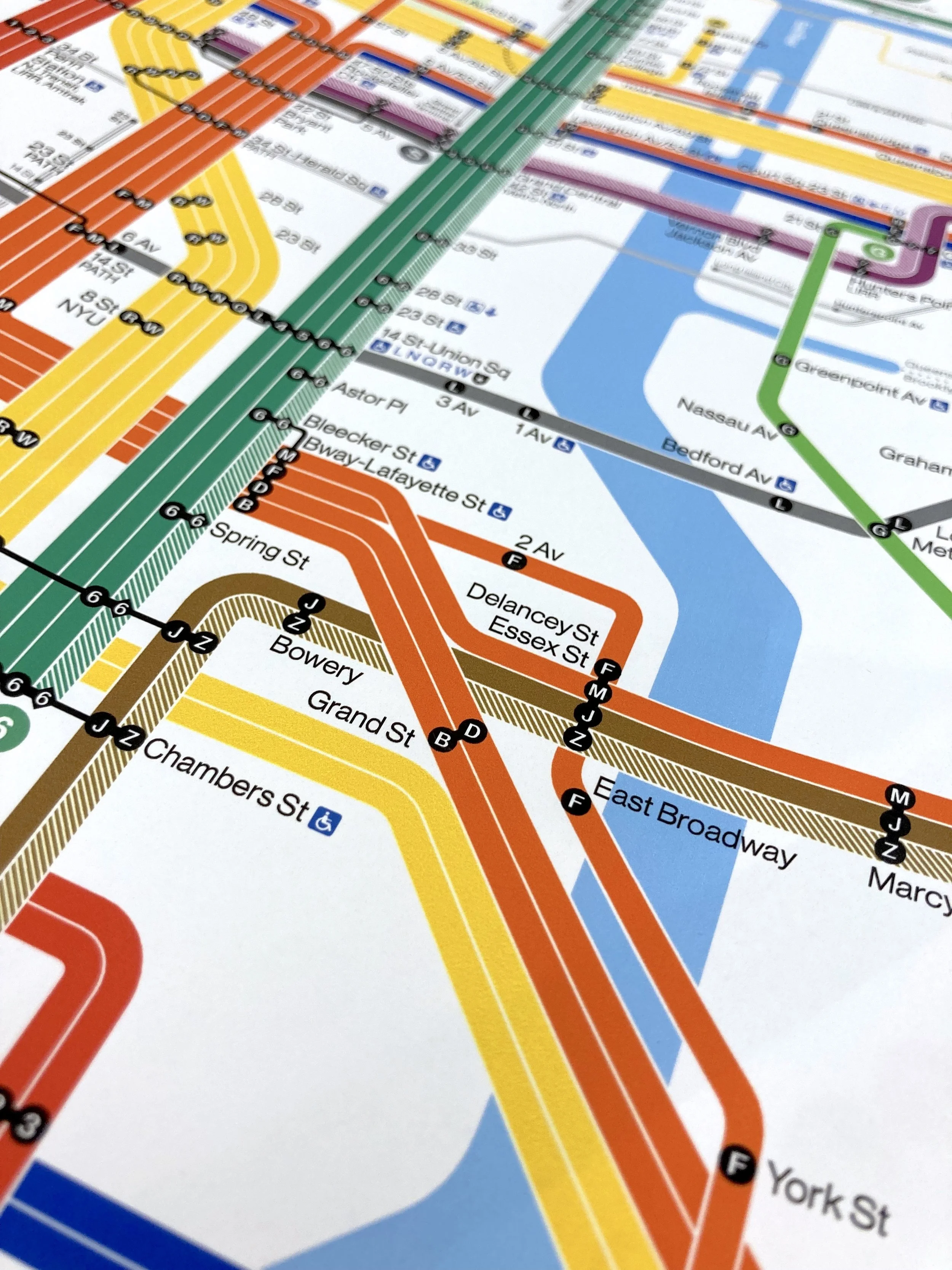
The Subway Diagram shows the citywide subway network with each service represented on its own line. The diagram prioritizes showing the network structure and connections over geographic specificity.
Role: I proposed the thicker line style, drew the first draft of the diagram with the new style, and participated in all subsequent design discussions.
Collaborator: Megan Rojek
Supervisor: Steven Flamm
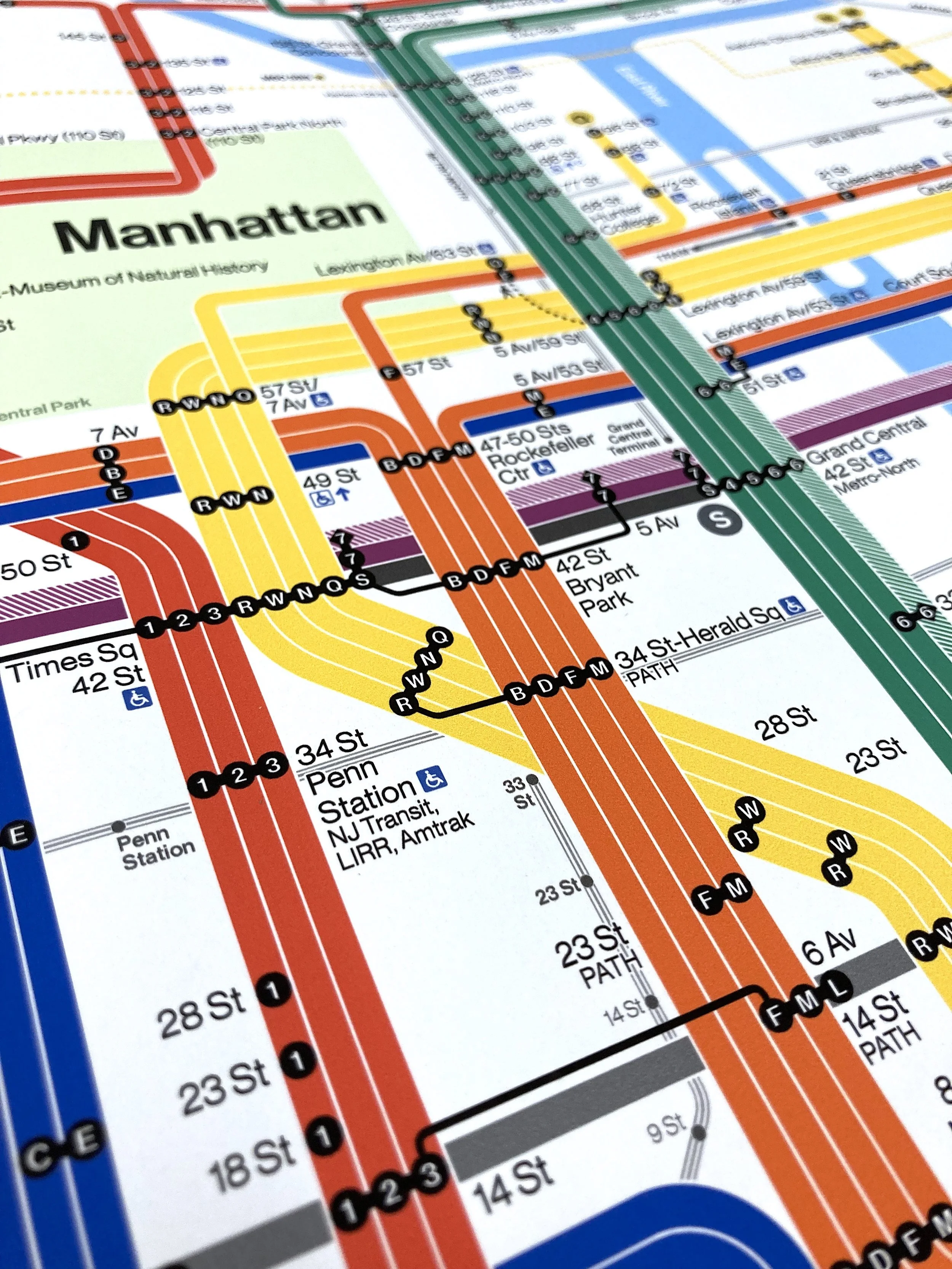
Midtown Manhattan
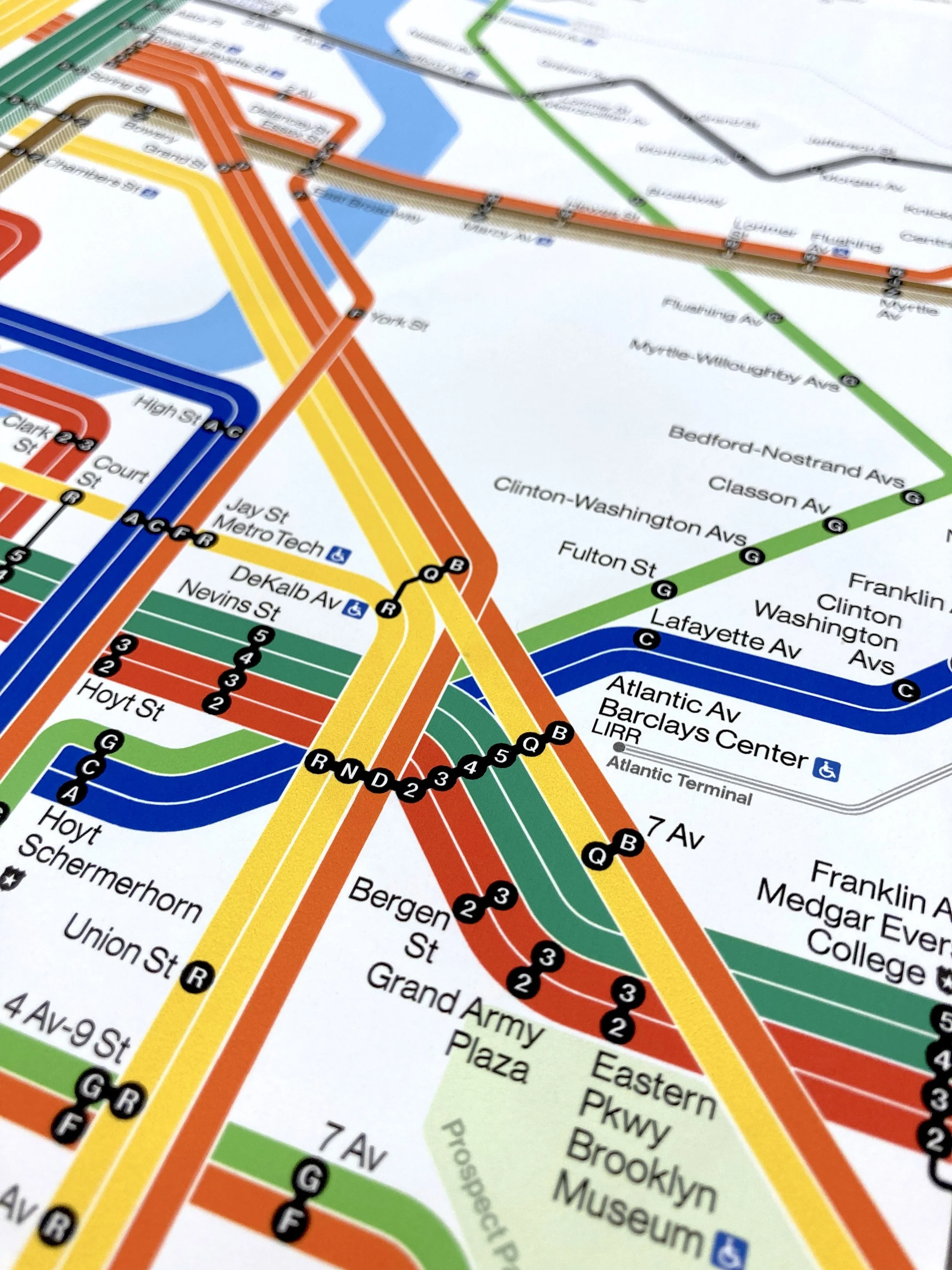
Downtown Brooklyn
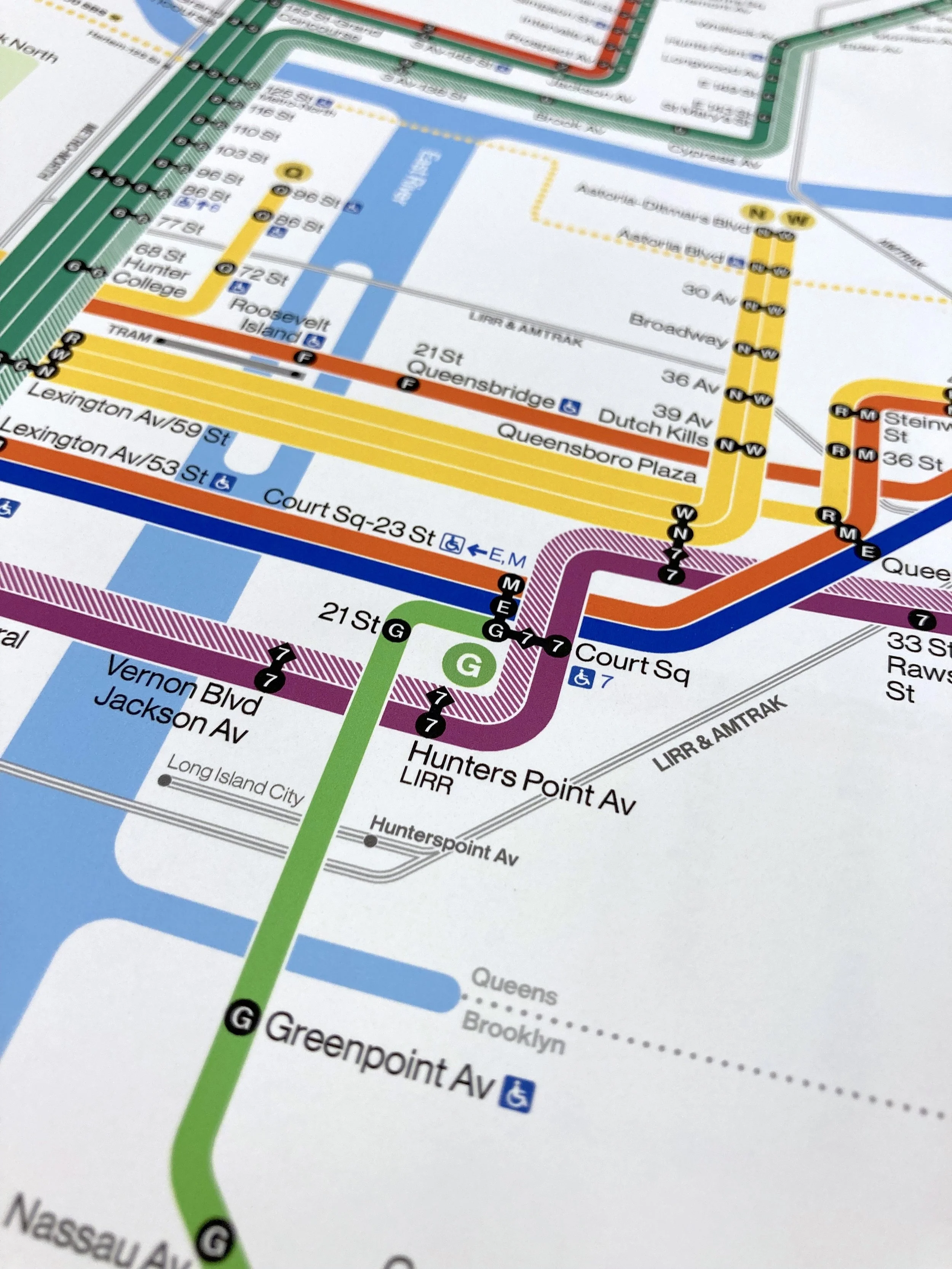
Long Island City
Lower Manhattan
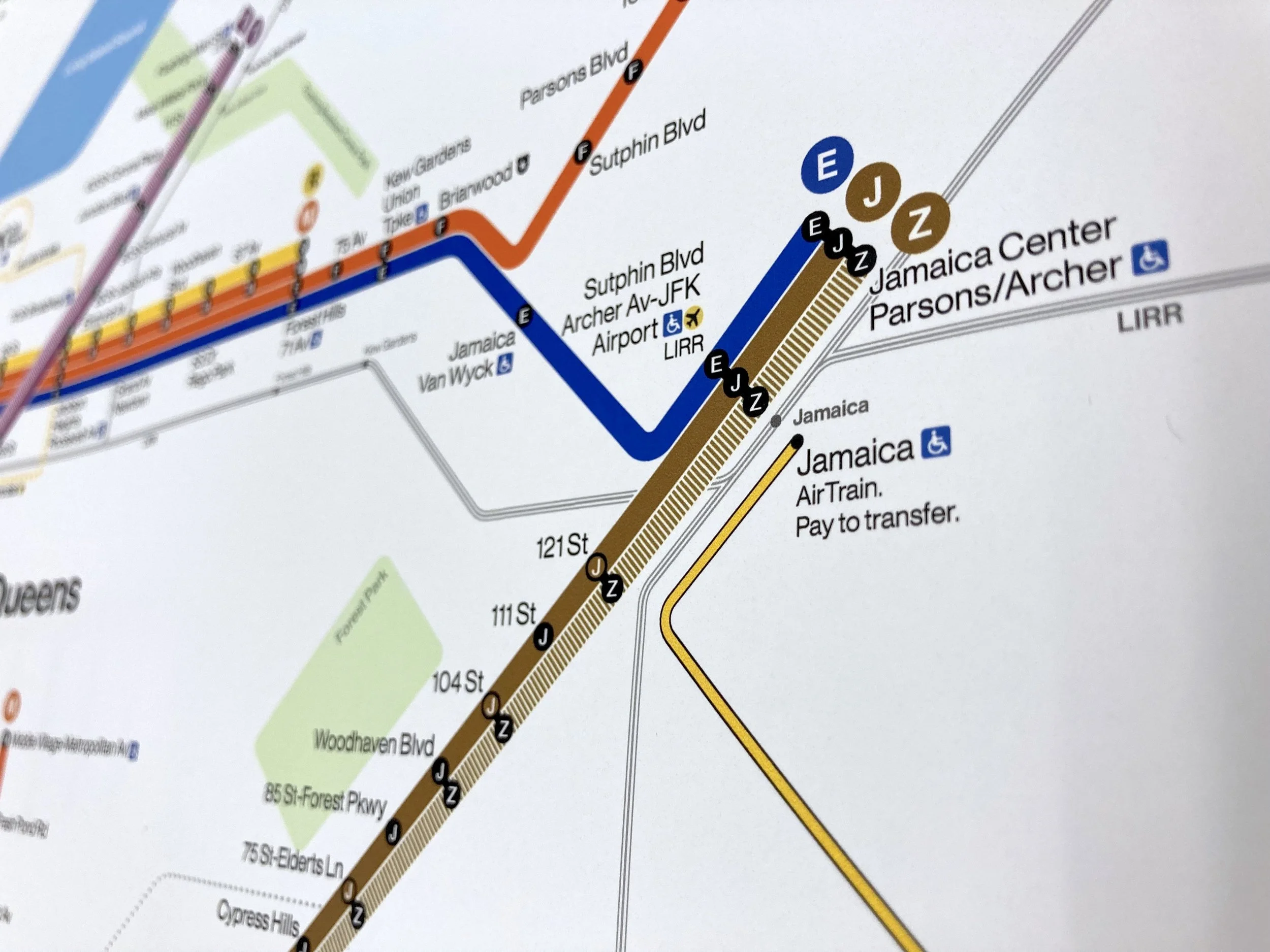
Jamaica